
- 27 000 $ (USD)
- 2 317 461.64 ₹ (INR)
- 23 098.50 €
- 1 525 188.41 ₱
- 0.2294
") (BTC)
(BTC) - 9.1136
") (ETH)
(ETH) - 27 000
") (USDT)
(USDT) - 165.7459
") (SOL)
(SOL) - 483 904.79 R
- 876 014.13 ฿ (THB)
- 20 002.95 £
- 150 122.71 R$
- 503 285.40 $ (MXN)
- 99 171.00 د.إ
- 36 988.65 C$
- 101 272.23 ﷼
- 41 042.03 A$
- 1 127 811.25 UAH
- 44 925.14 $ (NZD)
- 2 107 526.60 RUB
- 1 628 100.48 RD$ (DOP)
- 108 360 035.45 $ (COP)
- 34 074 906.31 $ (ARS)
- 258 130.82 kr (SEK)
- 211 943.24 元
- 14 015 823.24 KZT
- 273 455.99 kr (NOK)
- 21 498.70 ₣
- 89 940.51 ₪
- 25 845 297.55 $ (CLP)
- 13 613 838.82 ₡ (CRC)
- 193 550.84 圓
- 3 979 559.88 円
- 88 338.95 BYR
- 7 672 185 367.35 Bs (VEF)
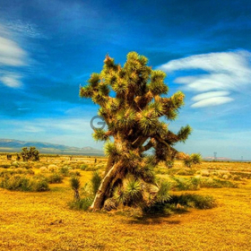
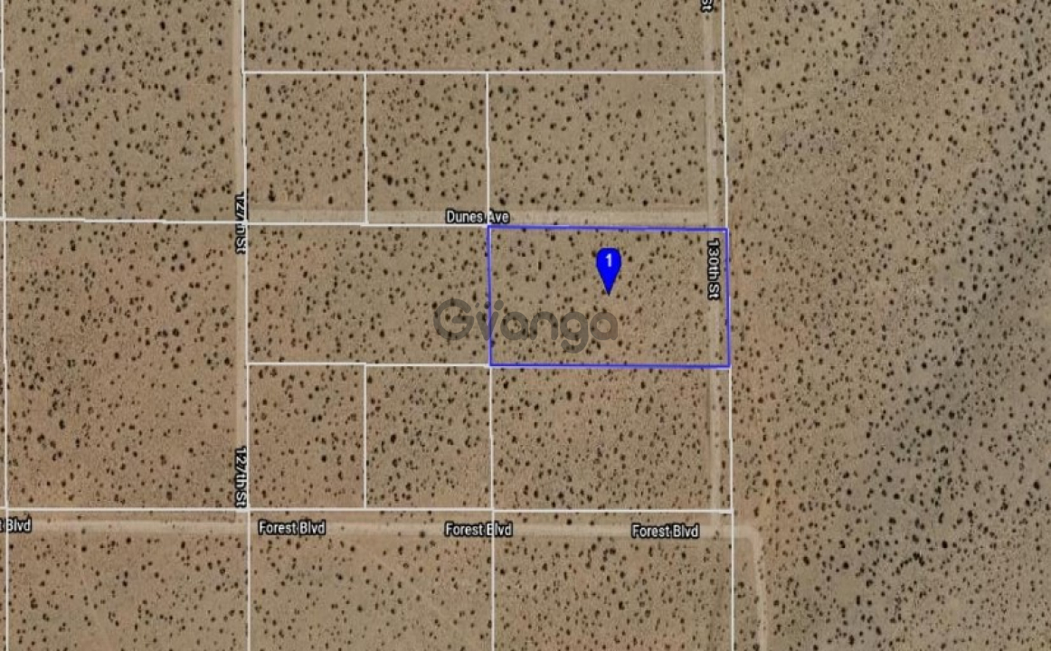
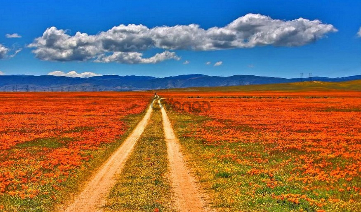
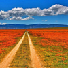
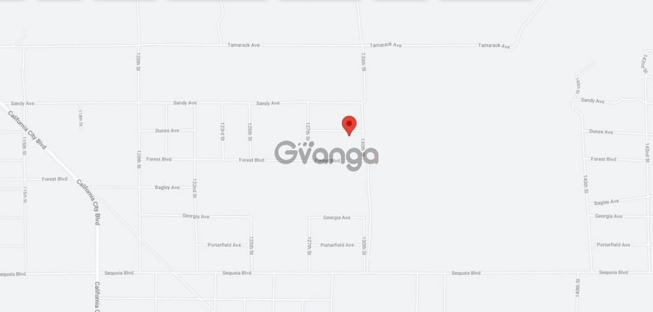
RANCH-FARM 5 ACRES Vacant lot in California City vicinity KERN COUNTYRANCH-FARM5 ACRES Vacant lot in California City vicinityKERN COUNTYThis property is located east of Mojave between the city of Aerial Acres and California City in Kern County. A really growing community. Enjoy the Wonderful 4 Seasons Weather, all in the growth in The Heart of This City Just across State Route 14, north of State Hwy 58 Barstow-Bakersfield and 395 Fwy. Aerial Acres is a fly-in unincorporated community in Kern County, California. It is located 5. 5 miles east-southeast of Castle Butte, at an elevation of 2428 feet. On the western edge of the Mojave Desert and the eastern foothills of the Tehachapi Mountains, Mojave is uniquely located at the cross-roads of two major highways and is central to many aviation, historical, and natural treasures and activities. Our list below samples just a few of the unique opportunities available to those who visit Mojave. Soledad Mountain Mining District Southwest of Mojave on Silver Queen Road off Highway 14. Gold and silver mining location since the 1890s. Plans are underway to revive the historic Golden Queen Mine. The mining ghost towns of Garlock, Ransburg, and Johannesburg in the Rand Mining District. Take Highway 14 25 miles north to the intersection of the Red Rock-Ransburg Road to visit historic mining communities of Ransburg and Johannesburg. Famous Tehachapi Loop railroad site west of Tehachapi, visible from Freeway 58 near Broome Road interchange, and on Tehachapi-Woodford Road. Historic railroad loop designed by William Hood in 1876 to help the Southern Pacific Railroad gain the summit of Tehachapi Pass. Perhaps the most famous railroad engineering site in the United States. For over 30 years, the mountains and foothills surrounding Mojave are home to wind farms generating electricity for Southern California. Known as the Tehachapi-Mojave Wind Resource Area, the area is considered one of the premier places in the nation for wind power and plays an important part in enabling the state attain its renewable energy goals. Happy InvestingAnd dont miss out on this oneProperty ProfileAPN 350-262-13-00Legal Description S 33 T 32 R 38 E12 OF N12 OF S12 OF SE14 OF NE14 EXUse Vacant LandZoning E 2 12 MLot Size 5 Acres 217,800 sq. ft. HOA NO HOA feesStateProvince CaliforniaDoc Type Grant DeedCounty KernCity Location California City, CA 93505 See Map. The photos 2, 4, 6, 8, 10, and 12 show the actual property and the surrounding lots. Photos 1, 3, 5, 7, 9, and 11 shows general area. We have also included a County Parcel Map and an aerial Map to help you. The assessors parcel number to the property in Kern is APN 350-262-13-00Here is a link including the GPS coordinates to view the location of the property on Google Maps35. 105805,-117. 897875You may have to copy and paste this to use it. Once the map pops up, simply use the zoom tool on the left side of that screen to view the map in more detail. You can even view an aerial photo by clicking on the Satellite tab in the upper right portion of that screen. All information we have on this property is disclosed within the content of the listing page. Any and all other information on this property should be directed toward the city or county of which the property is located in. Your due diligence should be performed, to ensure the property meets your needs and criteria.
Size
Browse all classified ads in category Land in California